Please enter your email address below, we will send you a notification email when the sale is available to view online.
A Selection of Auction Highlights


Lot 12 Estate / Collection: Property from an International Collector
Alice Ravenel Huger Smith


Lot 25
Iran Set of Gold and Enameled Stamps for the Coronation of the Imperial Couple
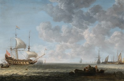
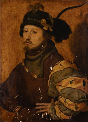
Lot 31 Estate / Collection: Property from a Prominent Private Collection
Simon Jacobsz de Vlieger

Lot 37 Estate / Collection: The Marion Oliner Collection
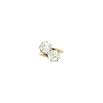
Gold and Diamond Ring


Lot 44
The Rules of St. Augustine about 1350, from an English priory


Lot 56 Estate / Collection: Property from a Philadelphia Estate
Harry Bertoia

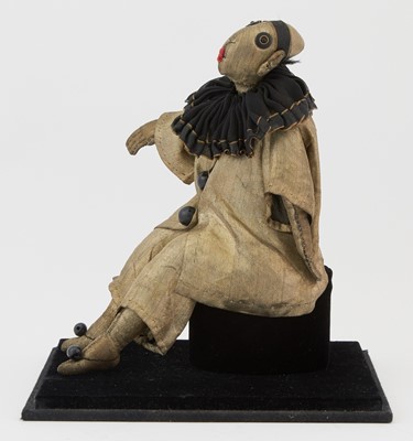
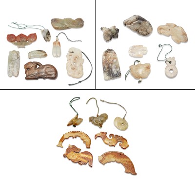
Lot 62
A Group of Twelve Chinese White Jade Zodiac Figures and Stands


Lot 73 Estate / Collection: The Estate of a New York Lady
Silver and Diamond Ring
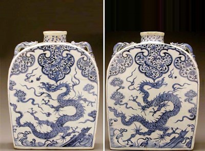
Lot 74
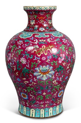
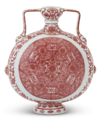
MASSIVE BLUE AND WHITE PORCELAIN 'PILGRIM'...


Lot 85 Estate / Collection: Estate of Hedda Kleinfeld Schachter
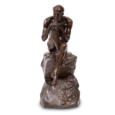
Antoine Poncet


Lot 108
Patek Philippe Gold Open Face Repeater Pocket Watch

Lot 110 Estate / Collection: The Estate of Gloria Naftali
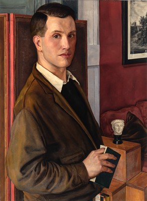
Joseph Christian Leyendecker


Lot 134 Estate / Collection: The Estate of a New York Lady
Silver and Diamond Ring

Lot 134 Estate / Collection: From the Collection of a Beverly Hills Artist
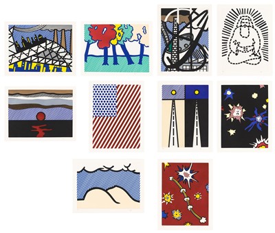
David Hockney (b. 1937)
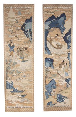
![Lot 136 - [ANGLING-MANUSCRIPT]
MARRIOTT, BENJAMIN. Trouting Along a Tributary of the Lehigh.](https://goauctiondoyle.blob.core.windows.net/stock/1647551-1-small.jpg?v=63826498504557)
Lot 136
[ANGLING-MANUSCRIPT]
MARRIOTT, BENJAMIN. Trouting Along a Tributary of the Lehigh.
Lot 136
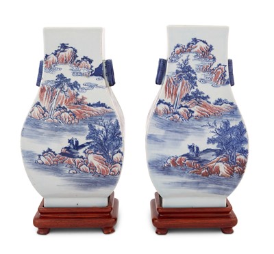
A Pair of Chinese Blue and White and Copper Red Porcelain Vases

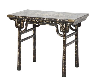
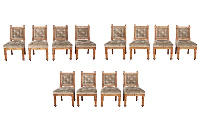
Lot 140
Pair of George II Needlework Upholstered Walnut Side Chairs
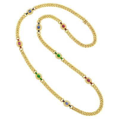
Lot 146
Long Gold, Multicolored Stone and Diamond Curb Link Chain Necklace
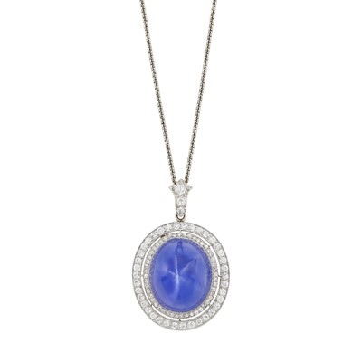
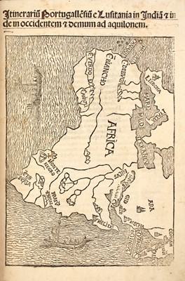
Lot 149 Estate / Collection: The Esmond Bradley Martin Collection
The remains of a library of Africana


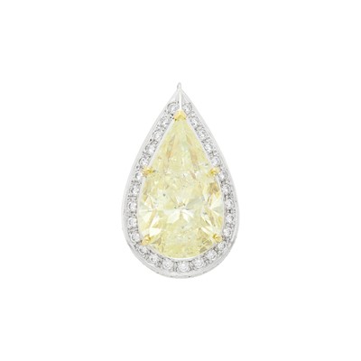
Lot 152
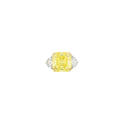
Two-Color Gold, Light Yellow Diamond and Diamond Pendant
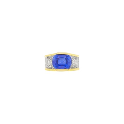
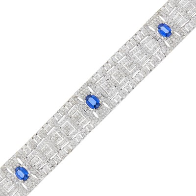
Lot 158
Bulgari Gold, Platinum, Kashmir Sapphire and Diamond Ring


Lot 167 Estate / Collection: The Irving and Joan Getz Collection
Andy Warhol (1928-1987)

Lot 169
Pair of Large Lapis Veneered and Gilt Bronze Urns

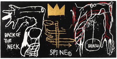
Lot 178 Estate / Collection: The Estate of a Prominent New York Chef
Jean-Michel Basquiat (1960-1988)


Lot 204
Pair of Gold, Angel Skin Coral and Diamond Pendant-Earclips

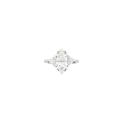
Lot 231 Estate / Collection: Estate of a Florida Collector
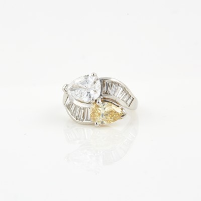
Platinum and Diamond Ring
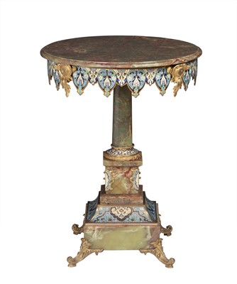
Lot 240
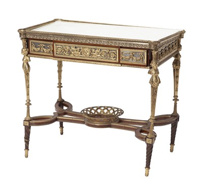
Louis XVI Style Gilt-Bronze Mounted Mahogany Center Table

Lot 241 Estate / Collection: An Important Private Collection
Platinum and Diamond Ring

Lot 243 Estate / Collection: The Collection of Joanne B. Breyer
Bulgari Platinum and Diamond Ring


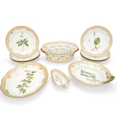
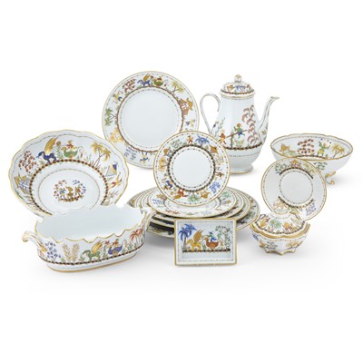
Lot 285
Assembled 'Tiffany Holiday' Garlanded Gilt-Decorated Porcelain Part Dinner Service


Lot 305
The Latin Grammar of Toulouse-Lautrec, illustrated with hundreds of small drawings

Lot 321
Louis XVI Style Gilt-Bronze Mounted Eglomise Bureau Plat
Lot 322
Tiffany & Co. for Le Tallec Porcelain "Cirque Chinois" Dinner Service

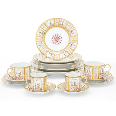
Lot 332
Le Tallec for Tiffany & Co. Porcelain "Carousel Chinois" Pattern Dinner Service
Lot 333
Tiffany & Co. for Le Tallec Porcelain Carousel Chinois Pattern Dinner Service


Lot 415 Estate / Collection: From a Private Collection in New York City
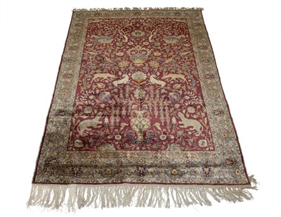
Kayseri Silk Rug
Lot 425
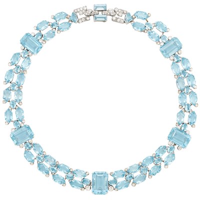
Art Deco Platinum, Aquamarine and Diamond Necklace, Cartier, London
