Please enter your email address below, we will send you a notification email when the sale is available to view online.
A Selection of Auction Highlights
Lot 11
Hispanic Society of America Sorolla Medal. c. 1937. Silver. 88mm. Uncirculated.
Lot 21
A Charles Addams theater advertisement "They laughed their heads off!"
Lot 25
Iran Set of Gold and Enameled Stamps for the Coronation of the Imperial Couple
Lot 26
Henri Edmond Cross French, 1856-1910 La Baie...
Lot 44
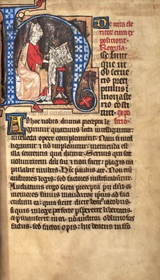
The Rules of St. Augustine about 1350, from an English priory
Lot 46
One of 15 copies on vellum of the Doves Press Sonnets of Shakespeare, in a Doves binding
Lot 58
Irving Penn, Young Orangutan and Coconut, New York, Oct 12, 2004
Lot 62
A Group of Twelve Chinese White Jade Zodiac Figures and Stands
Lot 62
Marcus Junius Brutus and P. Servilius Casca Longus. c. 43-42 B.C.E. AV Aureus (7.32g, 19mm).
Lot 63
Gold Neck Chain and Flexible Bracelet, 14K 460 dwt.
Lot 70
The iconic screen-used wall-mounted "M" from The Mary Tyler Moore Show
Lot 74
MASSIVE BLUE AND WHITE PORCELAIN 'PILGRIM'...
Lot 84
A Chinese Mother-of-Pearl-Inlaid Black Lacquer Recessed Leg Table
Lot 108
Patek Philippe Gold Open Face Repeater Pocket Watch
Lot 116
Twelve Royal Copenhagen Porcelain 'Flora Danica' Custard Cups with Stands
Lot 126
Two-Color Gold, Fancy Light Greenish Blue Diamond, Colored Diamond and Diamond Ring
Lot 127
Tiffany & Co. Sterling Silver "Flemish" Pattern Flatware Service
Lot 130
Signed documents and rare photographs, some relating to the Negro League player Percy Wilson
Lot 136
[ANGLING-MANUSCRIPT]
MARRIOTT, BENJAMIN. Trouting Along a Tributary of the Lehigh.
Lot 136
A Pair of Chinese Blue and White and Copper Red Porcelain Vases












![Lot 136 - [ANGLING-MANUSCRIPT]
MARRIOTT, BENJAMIN. Trouting Along a Tributary of the Lehigh.](https://goauctiondoyle.blob.core.windows.net/stock/1647551-1-small.jpg?v=63826498504557)

