Please enter your email address below, we will send you a notification email when the sale is available to view online.
A Selection of Auction Highlights
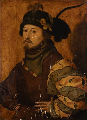


Lot 5 From the Collection of a Private Southern California Family
Thomas Hovenden


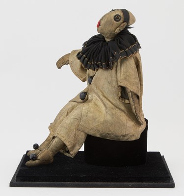
Lot 11
Hispanic Society of America Sorolla Medal. c. 1937. Silver. 88mm. Uncirculated.


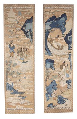
Lot 12 Property from an International Collector
Alice Ravenel Huger Smith


Lot 18 Property from a Private New York Collection
Russian Gem-Set Silver-Gilt and Cloisonné...


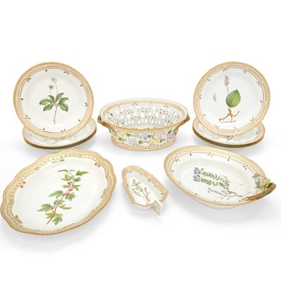
Lot 18 Property of a California Private Collector
Gutzon Borglum

Lot 21
A Charles Addams theater advertisement "They laughed their heads off!"


Lot 25
Iran Set of Gold and Enameled Stamps for the Coronation of the Imperial Couple

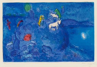
Lot 26
Henri Edmond Cross French, 1856-1910 La Baie...

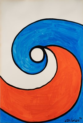
Lot 27 The Evelyn D. Farland Collection
Andy Warhol


Lot 31 Property from a Prominent Private Collection
Simon Jacobsz de Vlieger


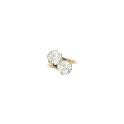
Lot 37 The Marion Oliner Collection
Gold and Diamond Ring


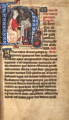
Lot 44
The Rules of St. Augustine about 1350, from an English priory


Lot 46
One of 15 copies on vellum of the Doves Press Sonnets of Shakespeare, in a Doves binding

Lot 46 The Collection of a Bay Area Family
Platinum, Emerald and Diamond Ring


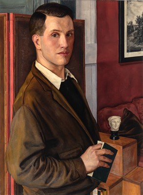
Lot 49 The Property of a Distinguished European Collector
French School


Lot 58
Irving Penn, Young Orangutan and Coconut, New York, Oct 12, 2004


Lot 62
A Group of Twelve Chinese White Jade Zodiac Figures and Stands


Lot 63
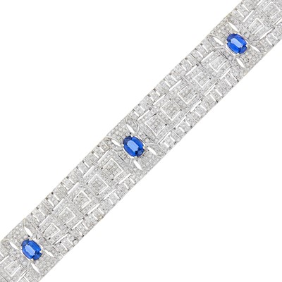
Gold Neck Chain and Flexible Bracelet, 14K 460 dwt.

Lot 64 The Estate of a New York Lady
Silver and Diamond Ring


Lot 65 The Eric Cohler Collection
Joseph Christian Leyendecker


Lot 73 The Estate of a New York Lady
Silver and Diamond Ring
Lot 74
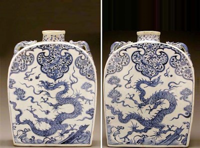
MASSIVE BLUE AND WHITE PORCELAIN 'PILGRIM'...


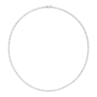
Lot 82 The Estate of a New York Lady
Silver and Diamond Ring


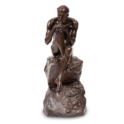
Lot 84 Collection of a Central Park South Artist
Frederic Sackrider Remington

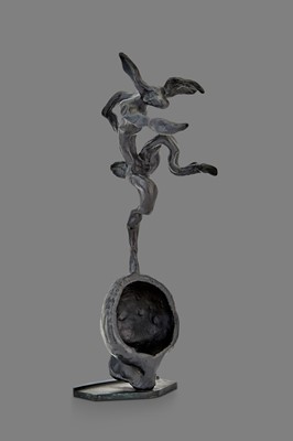
Lot 85 Estate of Hedda Kleinfeld Schachter
Antoine Poncet

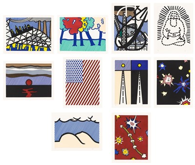
Lot 89 Property from the Estate of Elaine and James D. Wolfensohn
Roy Lichtenstein (1923-1997)

Lot 90
Audemars Piguet Gold 'Bamboo' Wristwatch, Ref. B88547


Lot 95 Estate of a Florida Collector
Long Gold Curb Link Necklace/Bracelets Combination


Lot 108
Patek Philippe Gold Open Face Repeater Pocket Watch

Lot 110 The Estate of Gloria Naftali
Joseph Christian Leyendecker


Lot 125 The Tina Hills Collection
A Magnificent Pair of Chinese Famille Verte Porcelain Rouleau Vases


Lot 130
Signed documents and rare photographs, some relating to the Negro League player Percy Wilson